|
Kungsleden & Kebnekaise Hiking in the Swedish Arctic July 20-26, 2007 | |||||||||||||||||||||||||||||||||||||||||||||||||||||||||||||||||||||||
 [The following journal was assembled for the crew members, their friends and
families. It is presented here without polish.]
[The following journal was assembled for the crew members, their friends and
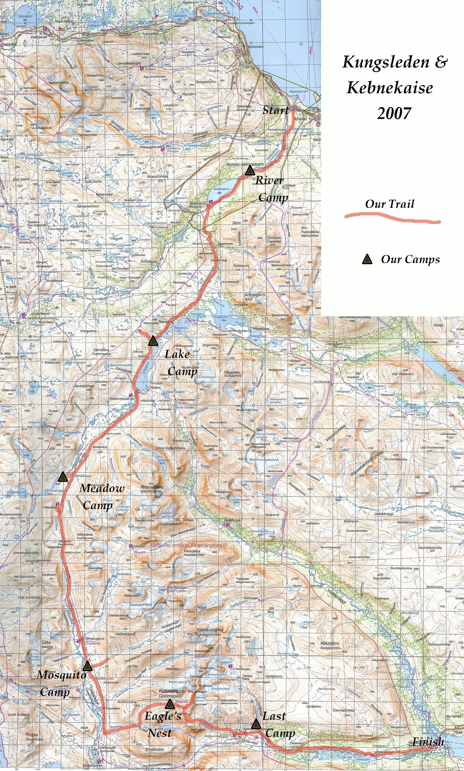
families. It is presented here without polish.]First, a bit of background to this hike. During the two previous summers our troop in Hanover has gone on a "Long Trail Hike", in 2005 it was 42 miles, in 2006 it was about 30 miles. I enjoyed these, and this year I still wanted to do something. So we decide to hike in the mountains of Sweden. Also, a good friend of my son and his brother come to Sweden from Hanover every summer. So we invited them to join us. Their father lives just north of Stockholm in Uppsala and has hiked and camped throughout Sweden. When he asked me what sort of place we were looking for I told him a place, "which doesn't look like the tree covered mountains of Vermont or New Hampshire". He suggested the "Kungsleden" - "The King's Trail". Click on any map or photograph for a larger version.
| |||||||||||||||||||||||||||||||||||||||||||||||||||||||||||||||||||||||
|
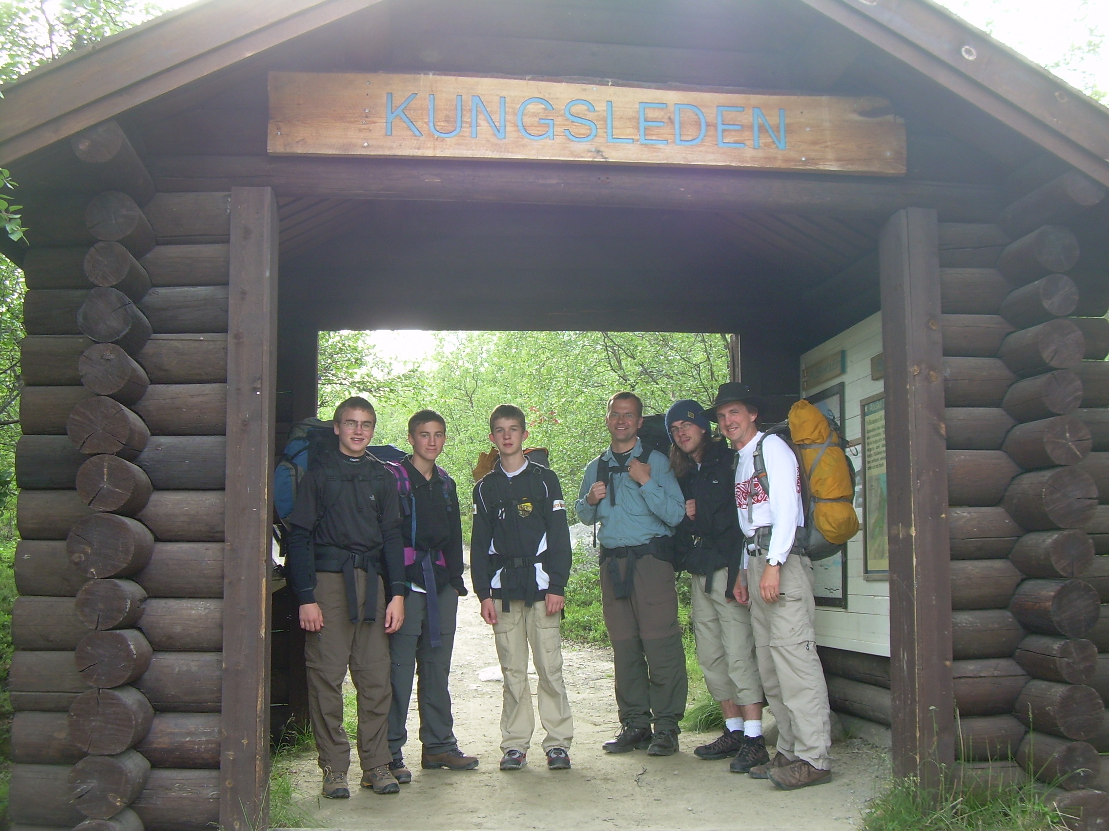
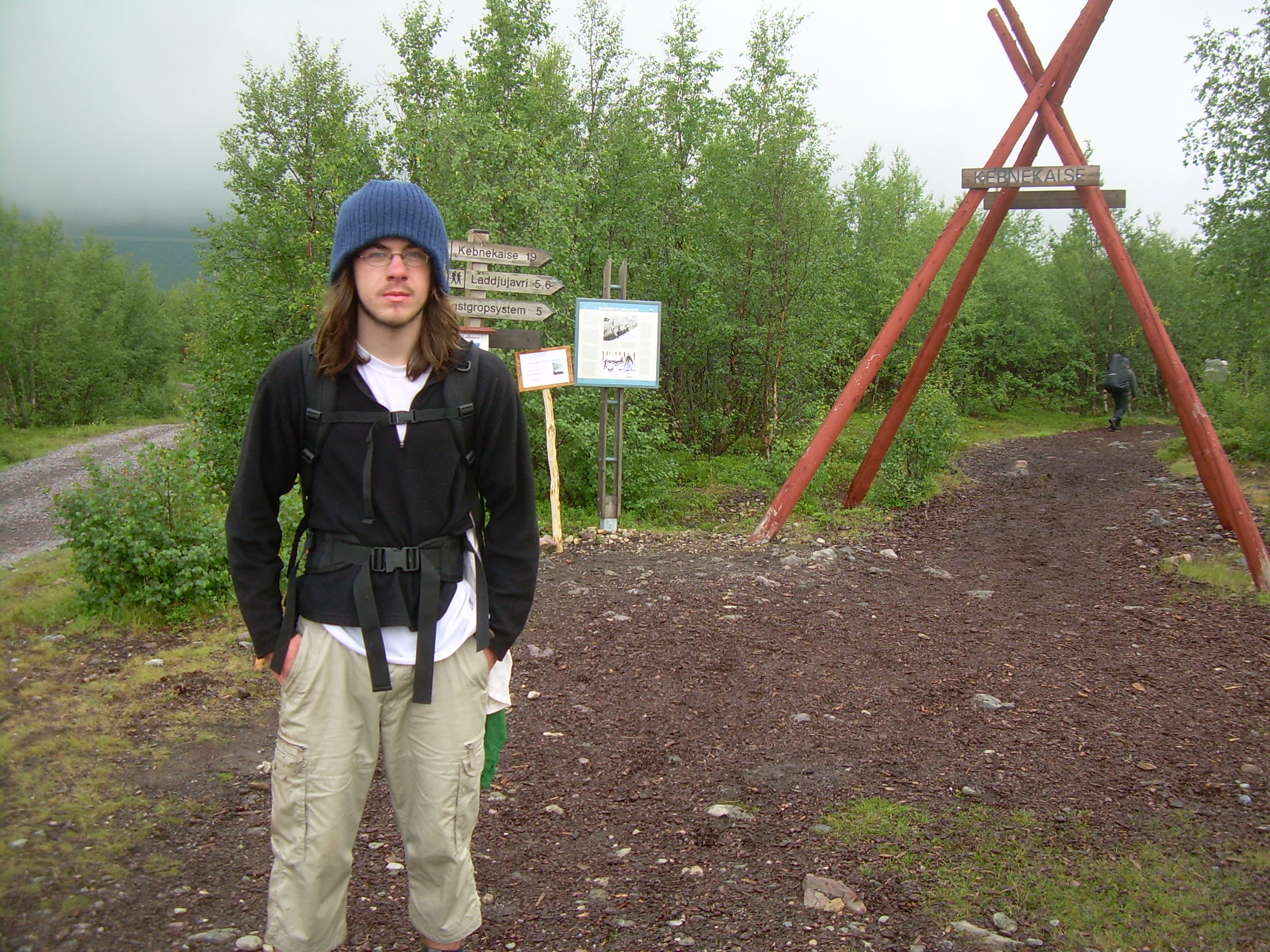
DAY 1 - Friday, July 20, 2007 Stockholm-Kiruna-Abisko-River Camp (9 km) We started the day by shouldering our pack in our apartment in Stockholm and hiking across Haga parken to the airport bus. At the check-in counter we met the Lithells (Per-Oskar, Markus and Gustav) and boarded a flight to Kiruna, about 1000 km north of Stockholm. There we soon found a bus (#91) to Abisko Tourist Station, which was our trailhead. We bought fuel for the stoves (you can not carry it on an airplane) and a last ice cream and stepped out on trail at 5:00 pm.
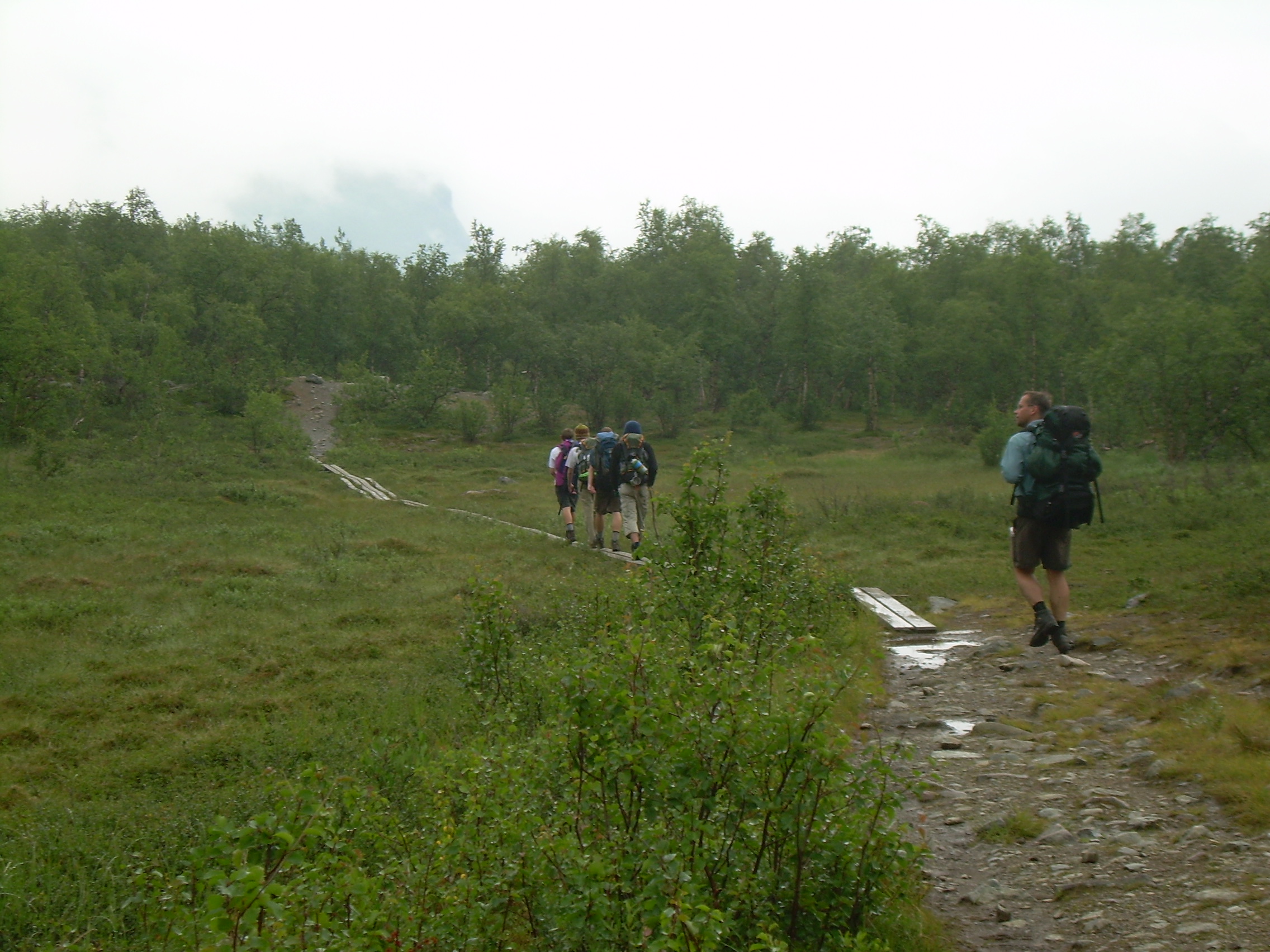
The trail was easy at the start, and we ticked off 9 kilometers following the Abiskojåkka (river) which is lined with willow. Farther from the water the trees are almost all birch. We made camp near the water, and cooked our supper. In the evening I climbed a rocky ledge and watched a hawk circling over the river.
Our hike is at 68.5 degrees north latitude - above the Arctic circle. This does mean that the winters are hard, but now in the summer it remind me of the landscape above the treeline in Colorado or Montana. I think the strongest Arctic attribute which we say was the amount of light. We started hiking at 5:00 and did not worry about dark - because it never got dark. It is true the sun sets (they had their first sunset in about two months a week before we arrived), but the sun is just below the horizon and it was never dark. This meant that we could have long evening walks, but it also made it hard to sleep at night. DAY 2 - Saturday, July 21, 2007 River Camp - Abiskojauestugorna - Lake Camp (21 km) It was cold overnight and I slept with my fleece on. I was stiff in the morning, and so went for a walk before getting everyone else up. Oatmeal will be our breakfast for the whole week. We didn't get on trail until 10:45 - but with all the daylight we could want this made little difference.
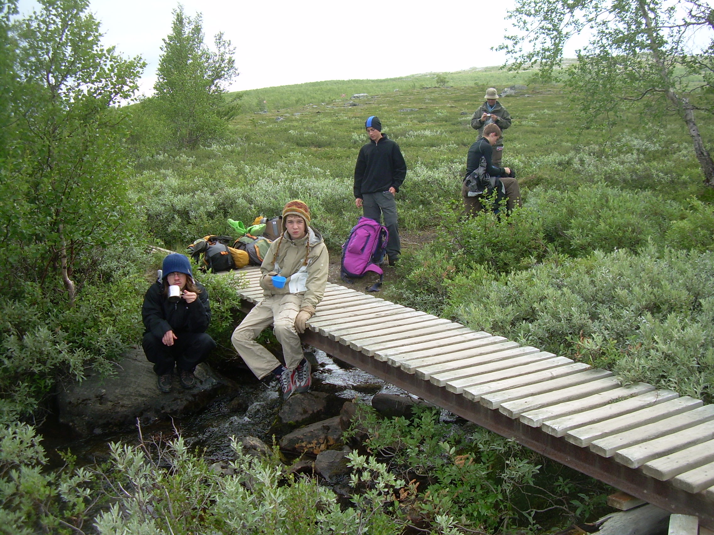
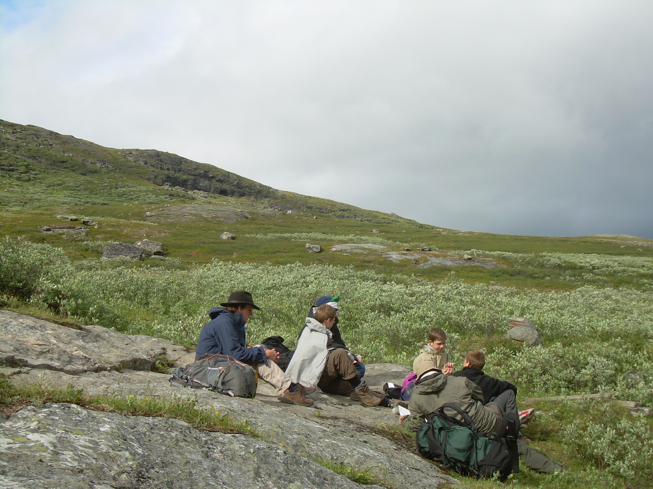
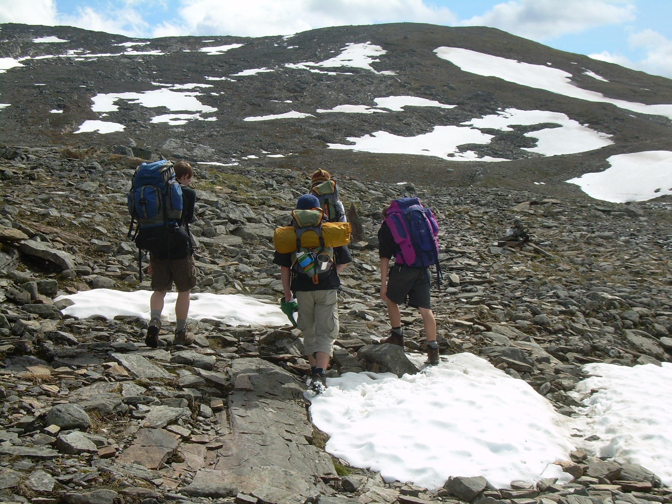
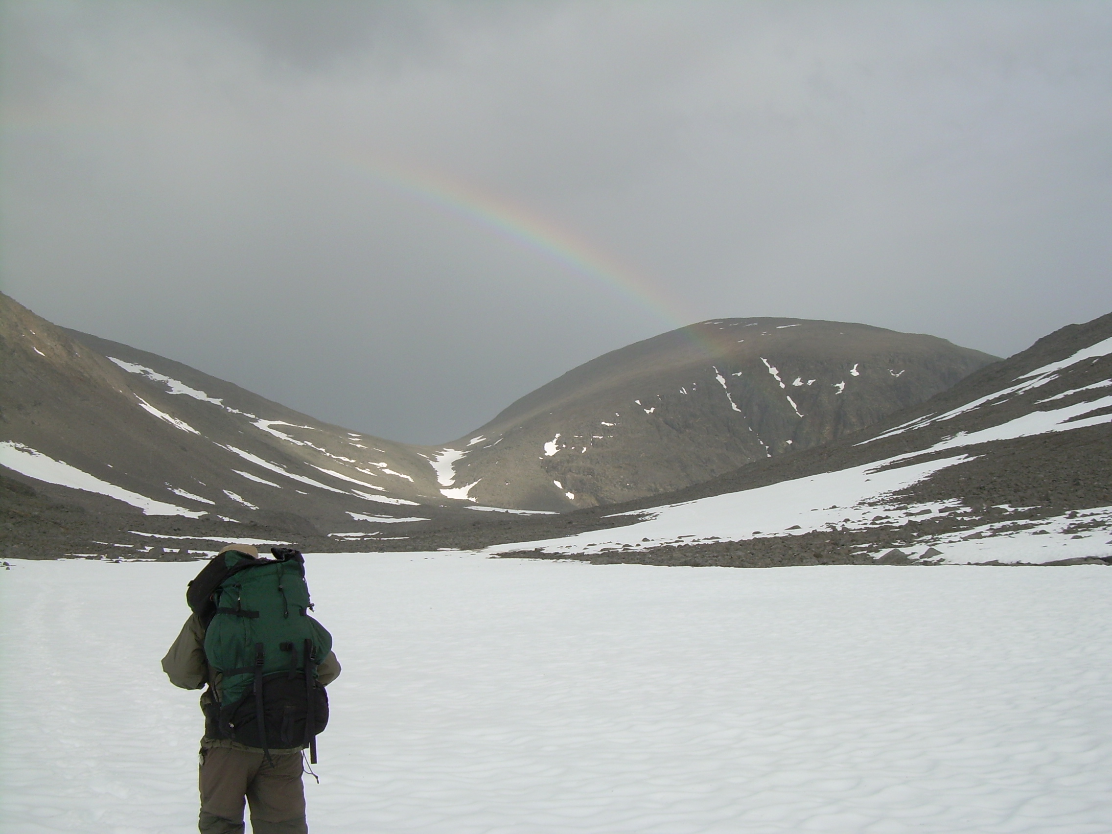
We now turned away from the lake and climbed into our first pass. Actually I think it may be more of a gap, since a single stream flows through it. The valley and stream are called Gárddenvaggi and the hill next to it Gárddenvarri. The boys say that this hill, bare and rocky, reminded them of "Weathertop" from Lord of the Rings. We have left the trees behind and will not see any more for a few days. It has started to rain a little, a cold drizzle, and the entire landscape is damp. We drink straight out of the streams here, and the Swedes in our crew do not even carry water bottles because there are so many streams everywhere. After the gap we came out into a valley which has a lake 20 km. long. Actually, according to my map it is a chain of half a dozen lakes. We also see a Sami summer village used when herding reindeer. Later, in the distance we see some reindeer. Evidence of the deer is everywhere, hoof prints in the mud and snow, and droppings. After about 20 km. of hiking we had hoped to find a willow thicket to camp in because of the rain and wind. But there are none. So we found a place where a bank gave us some shelter from the wind and we pitched our tents. After dinner it was not raining, although there are still mountains next to this lake I have not seen the tops of because of clouds. We climbed a hill behind our campsite and reached the top at about 9:00 pm. Our tents are tiny yellow specks 1-2 km below us.
The Sami are the native people of this region. There are the people who have often been called "Lapps". The word Lapp is apparently Finnish and may mean "people living on the edge, or outsiders". Recently it is sometimes used in a derogatory way - much like the word "hick".
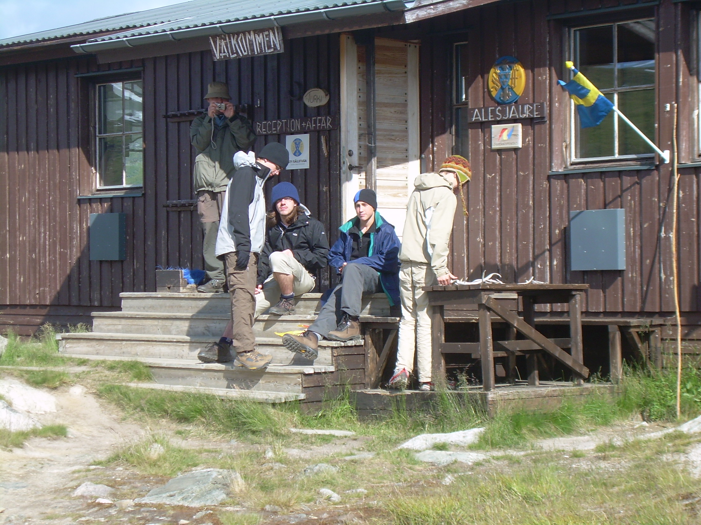
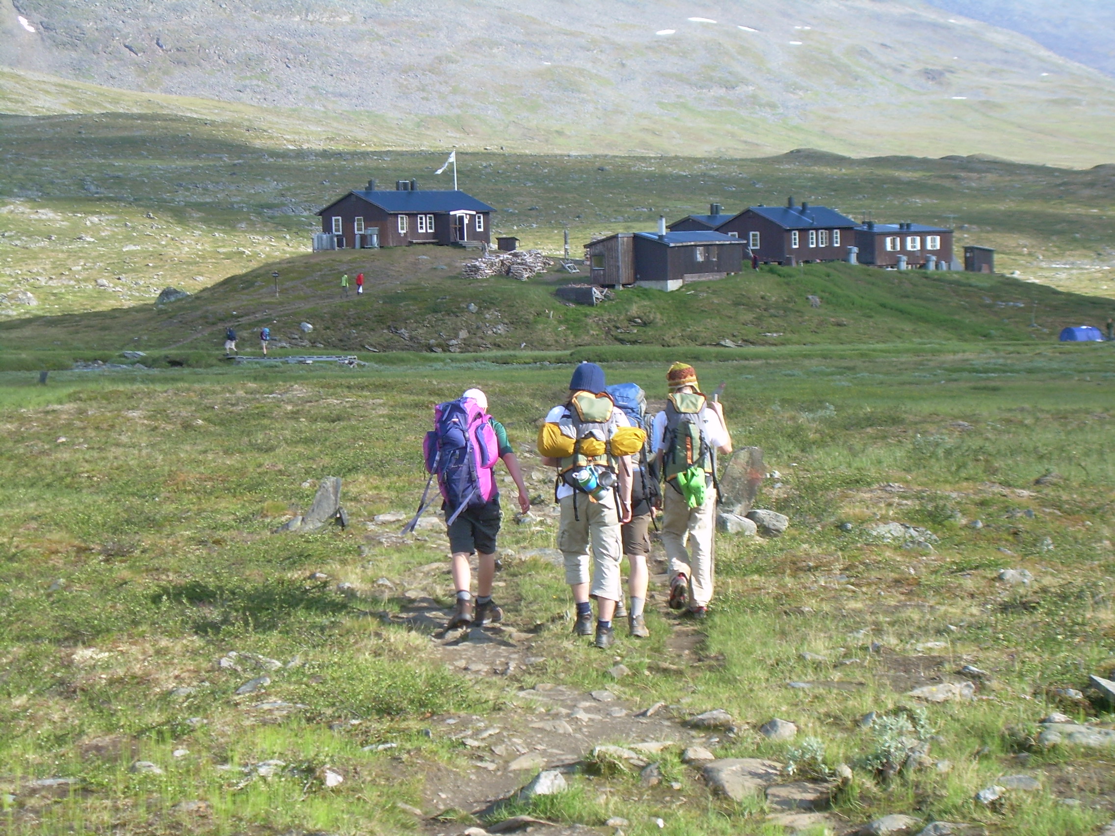
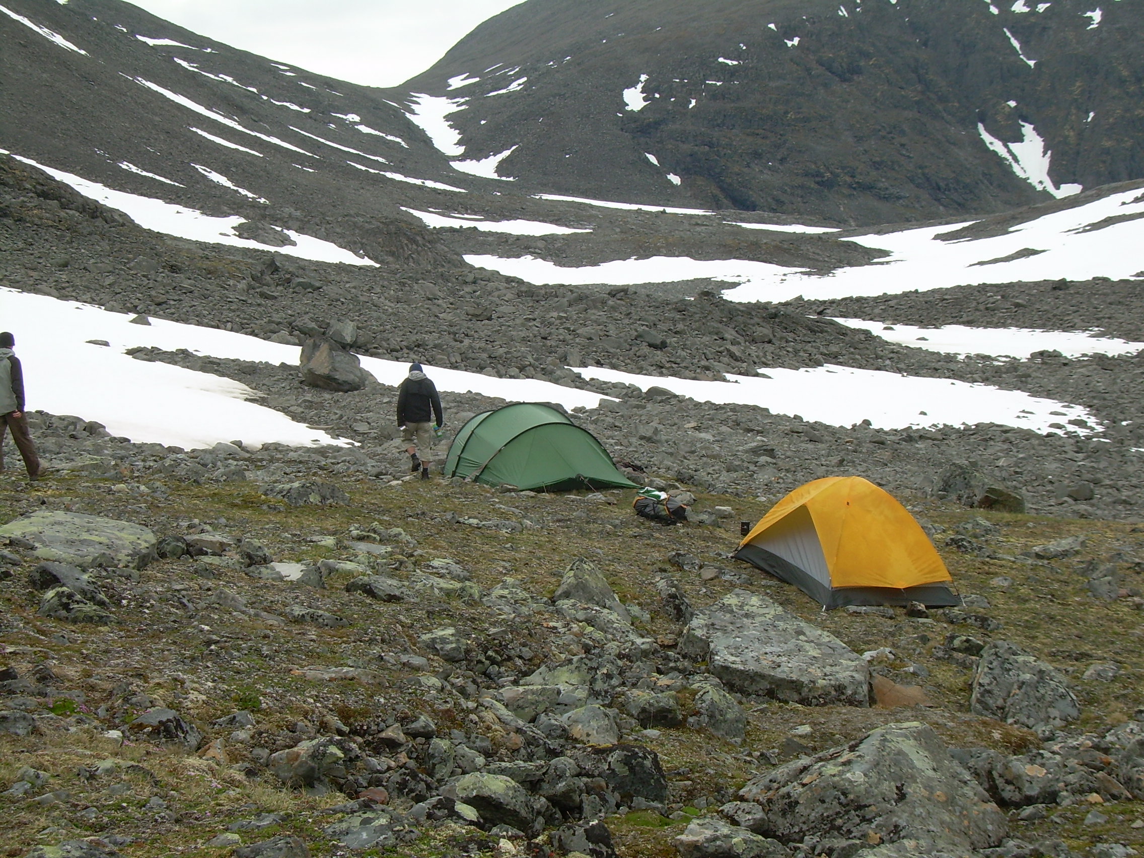
Lake Camp - Alesjaurestugorna - Meadow Camp (15 km) The morning was still cold and windy and we made our breakfast huddled against the bank which gave us a wind break. Markus is feeling ill this morning and we had long discussion as what to do. But time is on our side. We have an extra day in our schedule and we have made such good time that we can just hang out this morning and see how he feels. At noon we shoulder our packs and head towards the south end of the lakes. By the time we reach Alesjaurestugorna, the "hut" at the south end of the lake, Markus is back to normal. At Alesjaurestugorna there are half a dozen buildings including a small store. I am delighted to see that the prices are not too expensive and that they take credit cards! We buy tea, hot chocolate, crisp bread and dried soup. We also sat inside, out of the wind, for our lunch. Our trail now continues south along the Aliseatnu (river). This is open country. Kilometer upon kilometer of tundra. By the way, the word "Tundra" is Sami. That evening we set up camp in an area where the terrain is rolling. We tried to find a place where we are out of the main blast of the wind, but nor so sheltered that there would be clouds of mosquitoes. Just as we finish supper it starts to rain and we all crowd into the Lithell's tent. They have a four-man tent, with a large vestibule. It is cozy for the six of us. Actually it is nice to be warm.
DAY 4 - Monday, July 23, 2007 Meadow Camp - Tjäktjapasset - Sälkastuorna - Mosquito Camp (17 km)
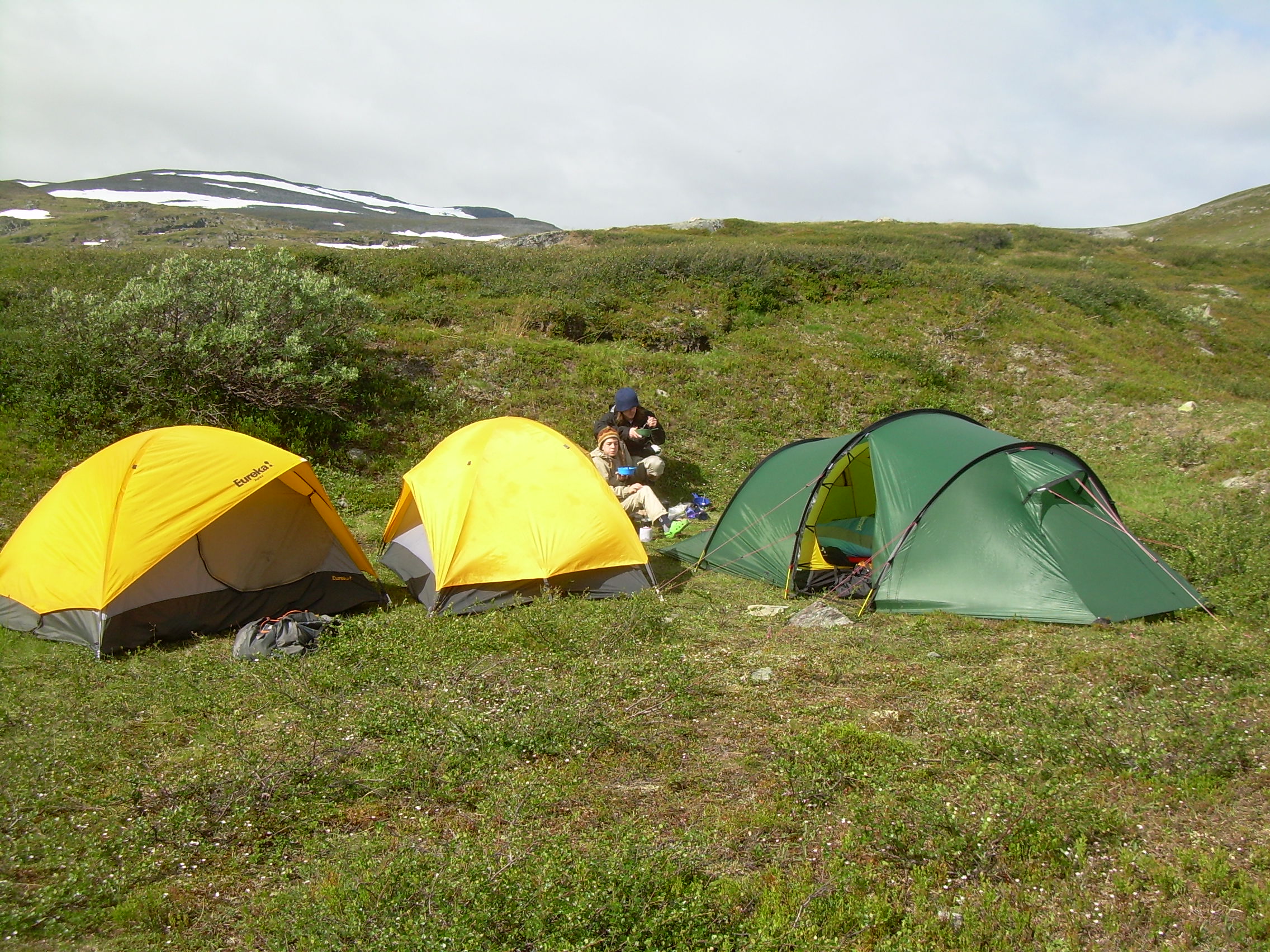
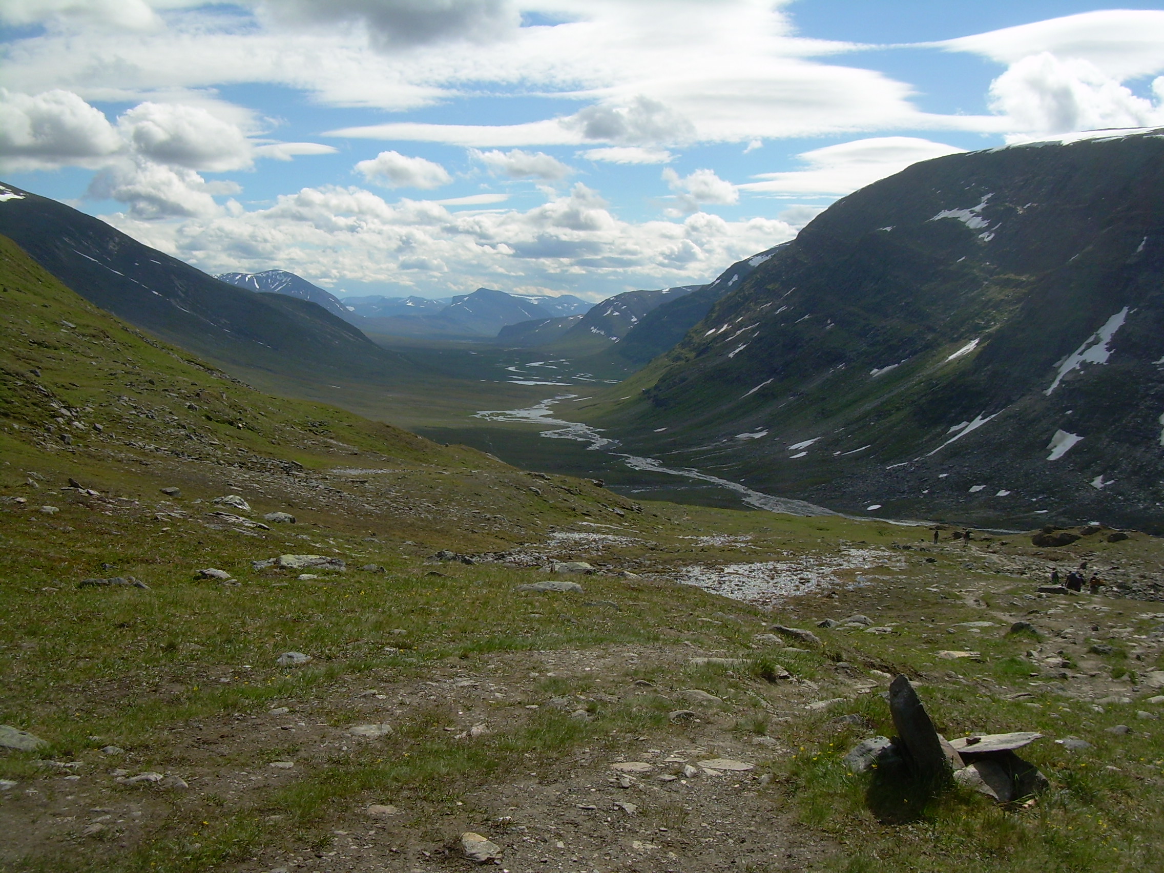
Once on trail we hiked up past Tjäktjastugan (hut) and on to Tjäktjapasset (pass). The last four kilometers of this was over broken stone, and was not easy. But from the top of the pass -- what a view! We are high up above the head of the next valley. We had our lunch just below the pass, and one of the resupply helicopters buzzed overhead. This valley is a classic glacial U-shaped valley. In fact just about everything I have ever heard about glacial geography is on display here. Moraines, hanging valley, and so forth. We stopped at Sälkastugorna for more food, and then established what I have named "Mosquito Camp". Actually the mosquitoes swarmed, but didn't bit as much as I would have expected. In the evening Will, Markus, Per-Oskar and I walk across the tundra to the east following the Gashkkasjohka (stream), until we climbed a moraine which separated the side valley from the main one. The stream has cut a sharp V-valley through the moraine - just as the text books say it should. Will found a good place near the stream and sat quietly carving long into the evening.
I had been warned about the mosquitoes in northern Sweden. Actually I think that they are no worst then in the woods of New England or many other places. In fact I meet a number of swarms which flew about you, but didn't actually land! I am use to the idea that mosquitoes are worst at about sunset, and I tried to look for this pattern, but with a questionable "sunset", I never really found a pattern. DAY 5 - Tuesday, July 24, 2007 Mosquito Camp - Eagle's Nest (14 km)
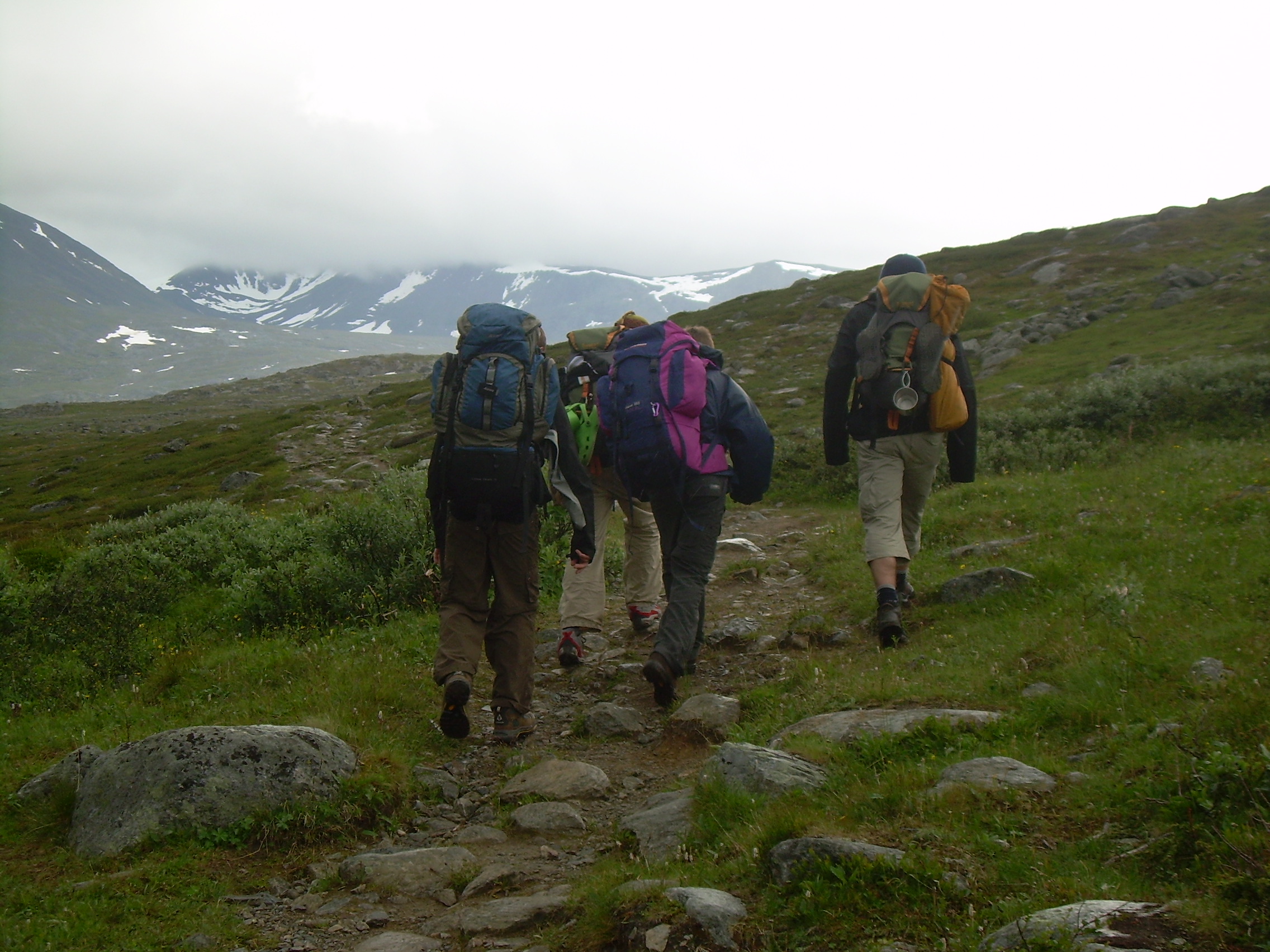
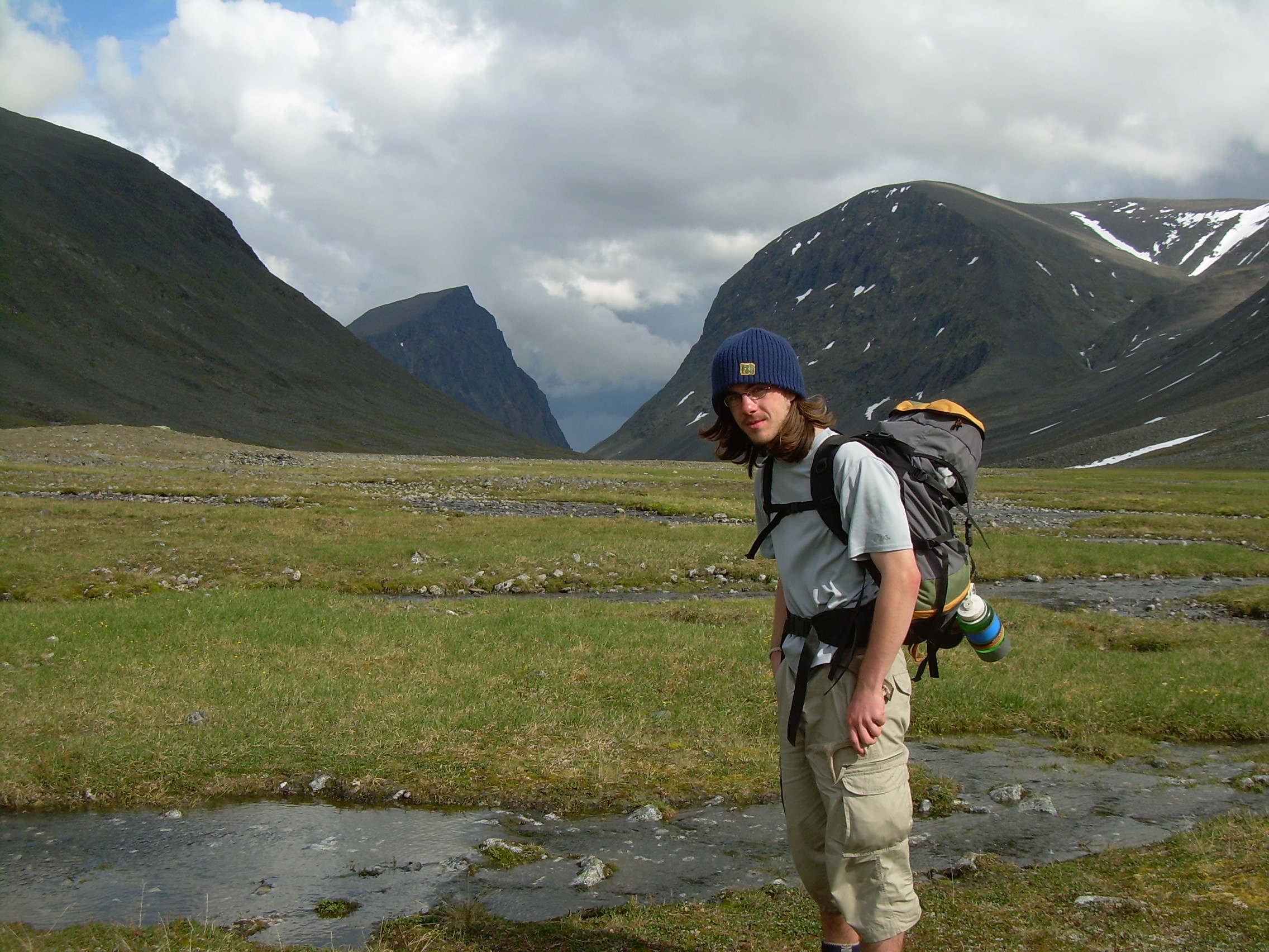
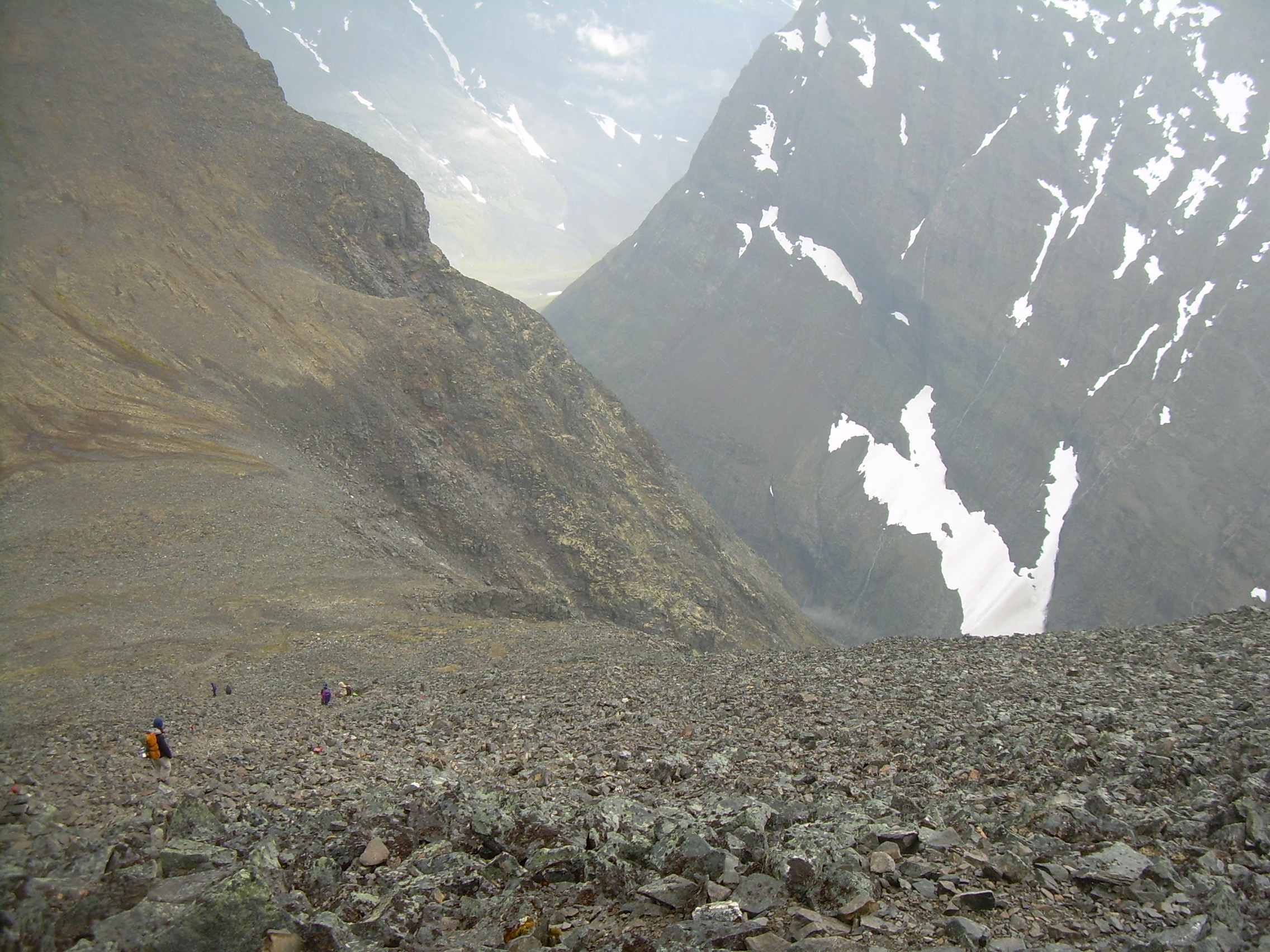
We crossed a stream which was almost milky in color. I asked the boys why they thought it was colored. Gustav eventually figured it out. This is what is called "Glacial Milk", and comes from streams which drain from active glaciers. The whiteness is actually powered stone, ground between the mountain and rocks frozen in the bottom of the glacier. Our original plan was to hike to Kebnekaise fjällstation (mountain station) today, and then climb Kebnekaise as a side trip tomorrow. This makes today a short and simple hike. Instead we turn off of Kungsleden - the main trail - and head cross country up the Sinnijohka (stream). Actually our map show this as an "unmarked trail". In fact there are cairns marching across the tundra. The main point of the "unmarked trail", I think, is that it indicates that the route is passable, there are no 5 meter cliff which might not show up on the map, but would mean you might not be able to cross.
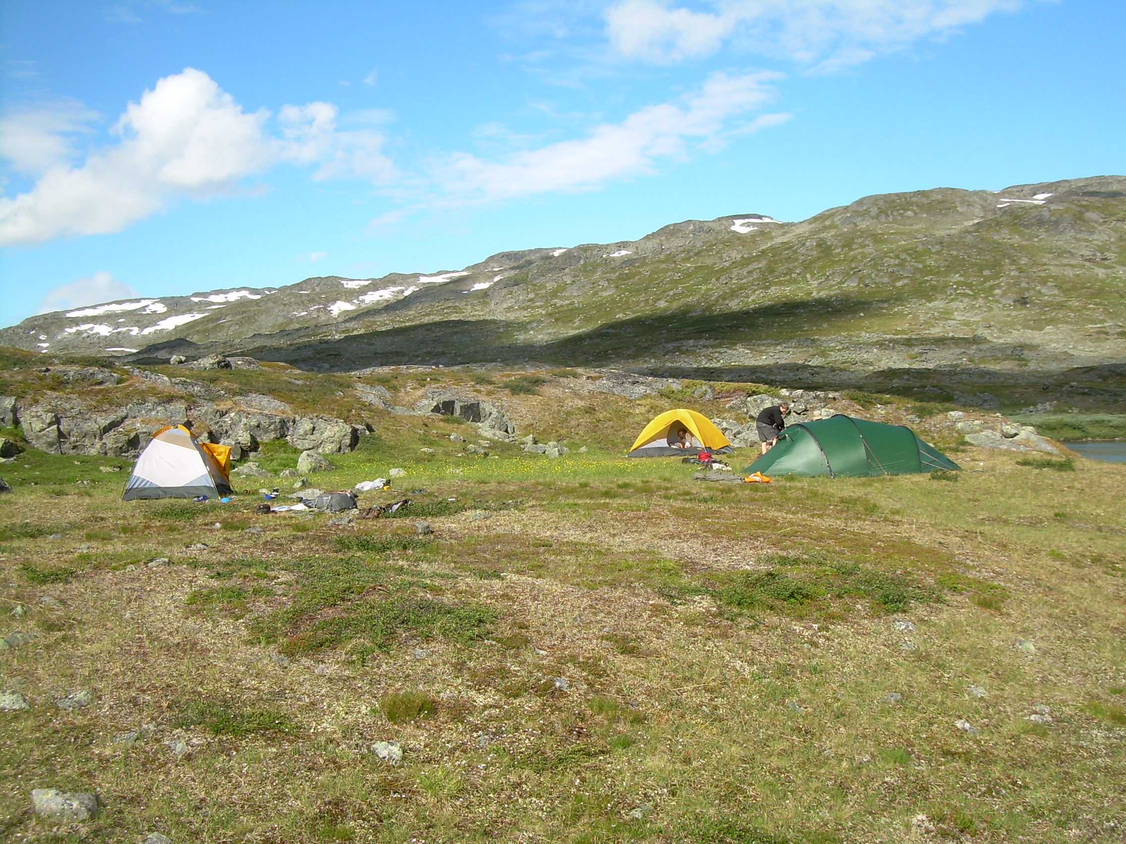
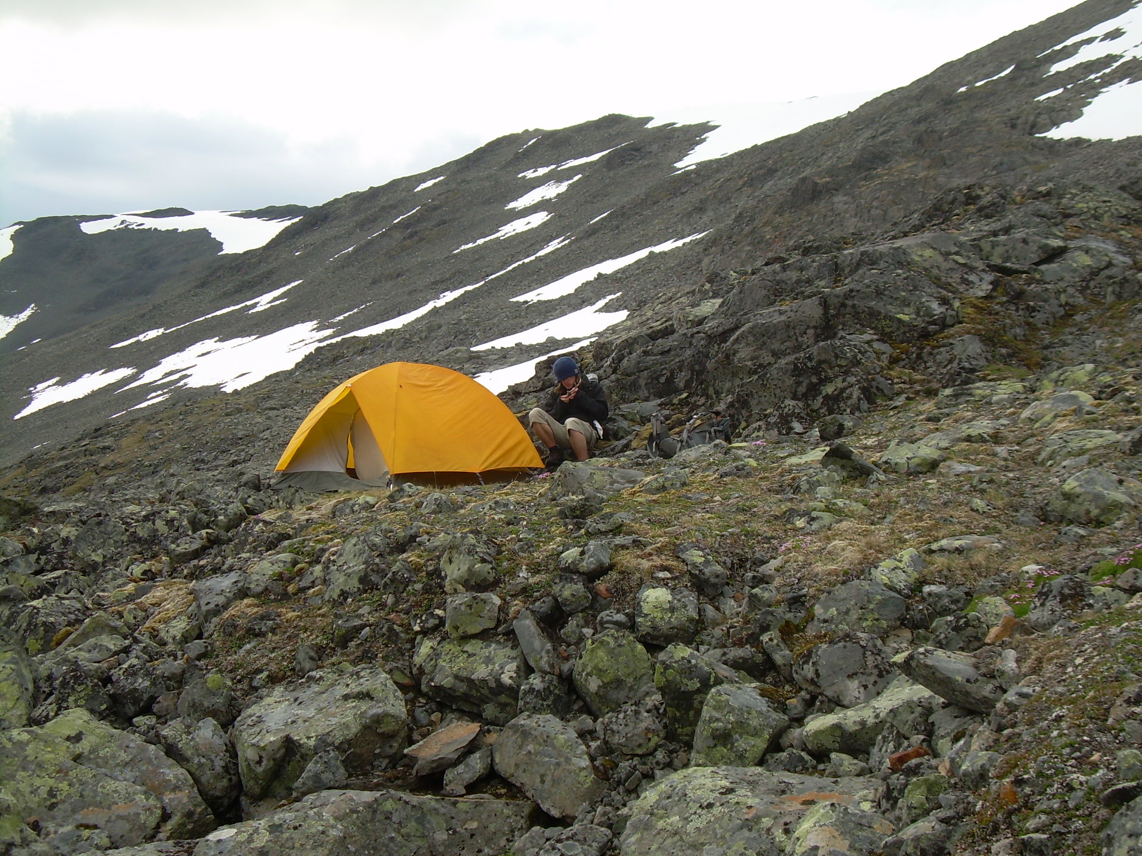
As we continue to climb the world becomes stonier and we tramp across more broken stones, boulder fields and snow. The snow is a relief to walk on - it is somewhat flat. There are rushing streams under part of the snow fields, so we move with caution - and do not cross the snow above the water. At about 5:00 pm we start looking for a camping places. We don't want to camp at any higher elevation and rain clouds keep rolling through the pass and up the side valley towards us. But it is hard to find anything but rocks and snow. Finally we spot a nearly level shelf 20-30 meters above the valley floor, just large enough for our tents. It even has a bit of grass and moss on it! Per-Oskar named it the "Eagle's Nest" because of the way is looks out over the valley floor. After supper Will carved a reindeer horn he found and the other three boys tossed rocks down a cliff face trying to crack them. What is a few more broken rocks among the millions in that valley? It has been raining off and on all evening.
DAY 6 - Wednesday, July 25, 2007 Eagle's Nest - Kebnekaise - Last Camp (14 km)
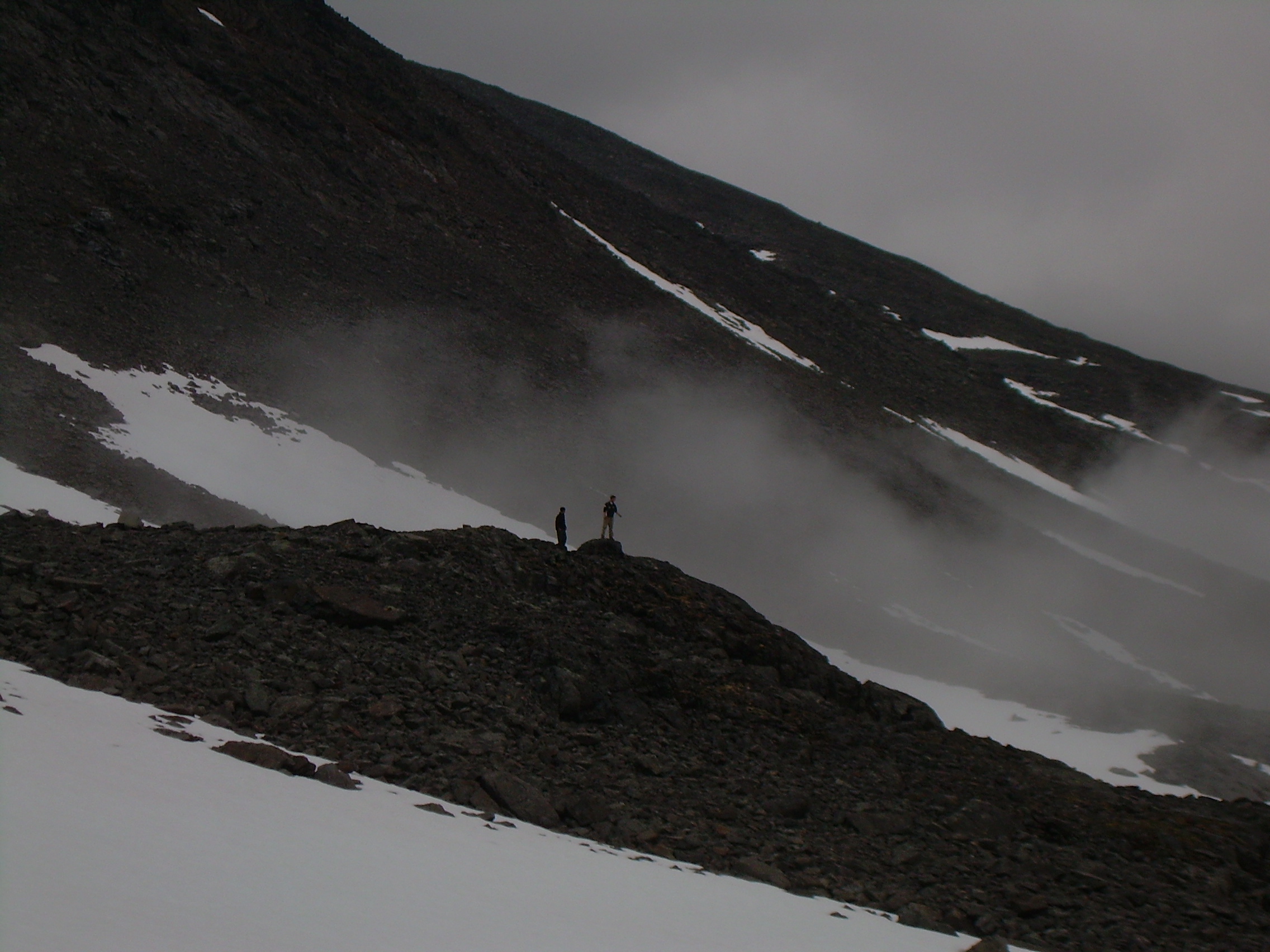
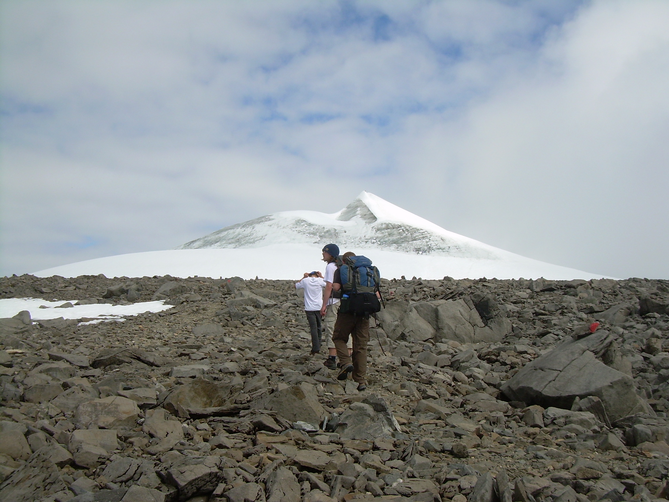
It has stopped raining at 3:00 am and I was tempted to get the crew up very early, but I also think this would have lead to a revolt. Still, we got up at 7:00 and shouldered our packs at 9:00 - which was early for us. It took us an hour and a quarter to get to the pass between Kebnekaise and Vierranvárri - the next mountain south. This is only a kilometer horizontally and about 200 meters vertical from our camp at the Eagle's Nest. We still have 2 kilometers and 500-600 meters vertical. So we cache our packs and continued with two light packs containing only rain gear and some food and water.
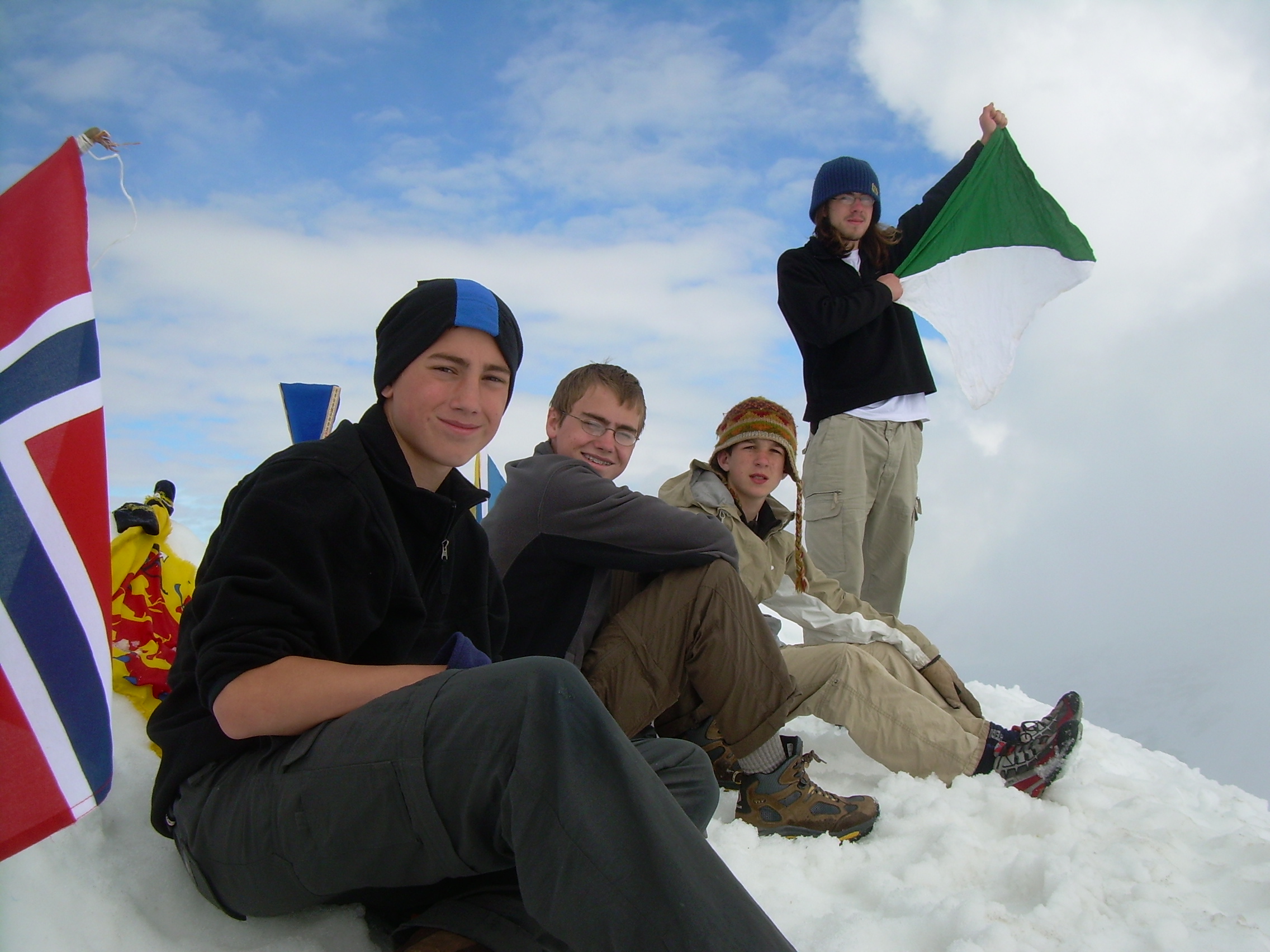
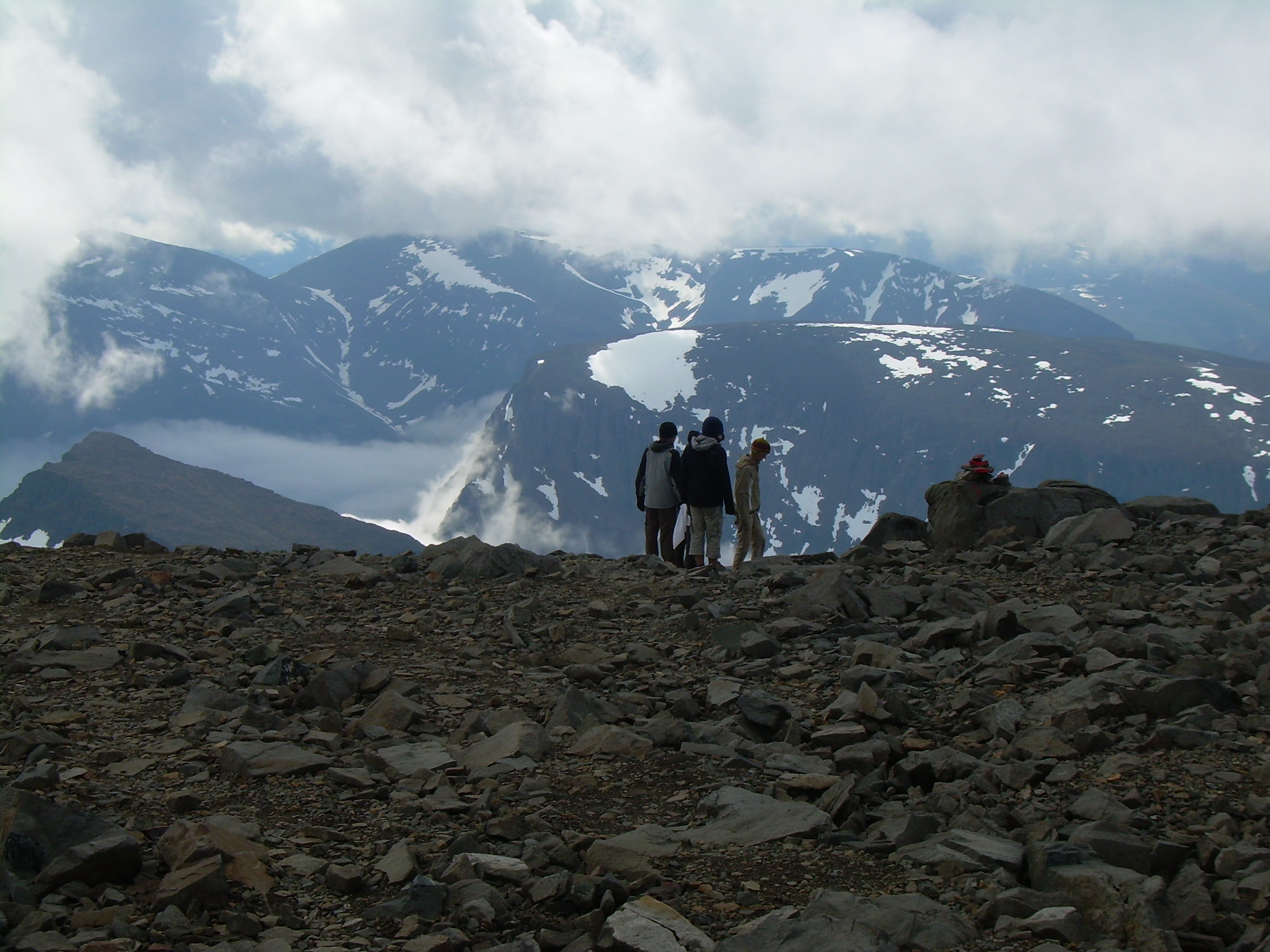
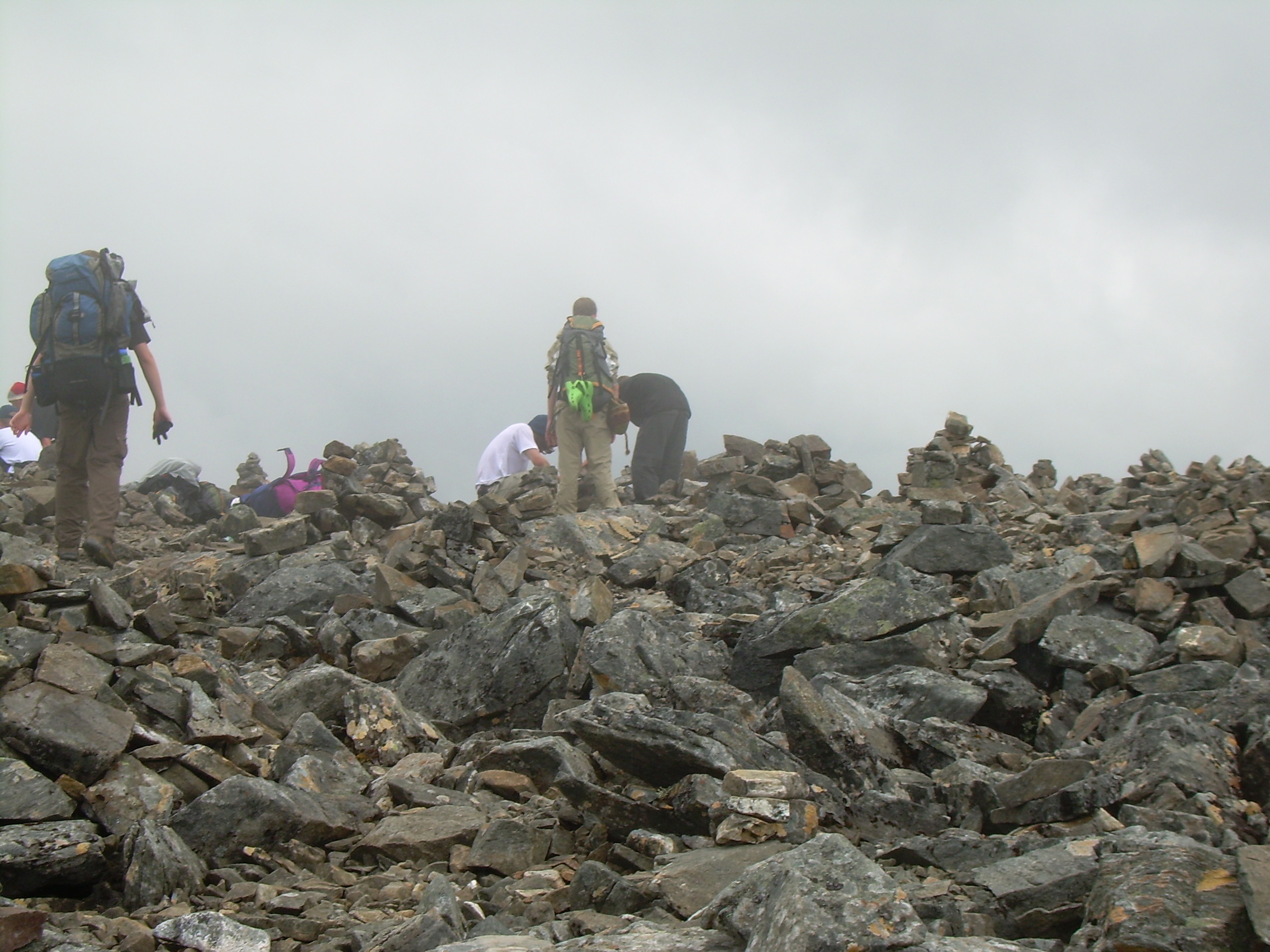
And then we can see the peak - and it is dumbfounding. We have been tramping across stones for hours now, but the last fifty meters is snow and ice. The peak looks like a miniature model of the Matterhorn, a spike of ice, a crown on top of the peak. A ridiculous design! The peak is on a knife edge between the Björlings glaciär to the east and the Rabots glaciär to the west. Rabots was the first person to climb Kebnekaise. We crawled up the snow to the peak, which was covered with flags people had left behind. The flag of Sweden, Norway and the Sami flag were on the peak. Will waved the Troop 45 "field flag" (class-B neckerchief) on the peak. We could not really see the Björlings glaciär because the clouds below us in the east, but to the west we can see down hundreds of meters to the Rabots glaciär. After ten minutes we returned to the rocks and ate chocolate. The decent to our packs was fast, and then we cooked lunch in the rain. After lunch we climbed Vierranvárri. This mountain is nearly as steep as Kebnekaise, but not as tall - which is good since we now have full packs. On the top - in the mist - are hundreds of cairns. It is a bit surreal. The boys add one more to the collection, and then it is time to descend. It is all down hill from here. We can drop the last hundred meters to the valley floor by sliding on a snow field! Now it is a straight forward decent to Kebnekaise fjällstation. We resupply but leave as soon as we can. This mountain station is very busy with many more people then we have seen this last week and we are happy to escape. Another 2 kilometers and we set up our last camp site.
Kebnekaise is the tallest peak in Sweden. It is also the tallest peak in Europe north of the Arctic circle. The name from Sami Giebmegáisi, means "Cauldron Crest", which I think refers to the cauldron formed by the Björlings glaciär. The ice of this glacier extends even to the peak. Of course classic glacier ice comes from being compressed under a thick layer of snow. I expect that this ice is just clouds colliding with the mountain top. DAY 7 - Thursday, July 26, 2007 Last Camp - Nikkaluokta - Kiruna (17 km)
We are back to the willows along the water and the birch trees, much like the landscape of our first day. I was concerned about how fast we could hike because I knew that there were a number of blisters in the crew, but that didn't seem to slow down anyone as we started logging 15 minute kilometers. We stopped as noon for a quick snack of cheese, crisp bread and chocolate, and then continued. At one point you can ride in a boat for five kilometers. On foot we made nearly as good a time as people in the motor boat. And finally - Nikkaluokta at 2:00. We walked 17 kilometers in 4 ½ hours! We now had three hours to wait for the bus. We bought and ate soda and ice creams, and then ate everything in our packs (lot of soup, crisp bread, cheese and ost-in-a-tube). That is the end of the hike - but I think I'll also give a quick account of our return to Stockholm. The bus (#92) took us to Kiruna where we stayed in the "Hotell Kebne". That night, after lots of showers and soap, we ate at a Boston style sports bars called "O'Leary's".
Summary of Distances
| |||||||||||||||||||||||||||||||||||||||||||||||||||||||||||||||||||||||
